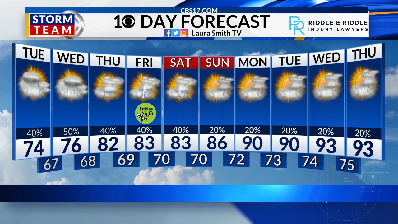
We will have one more unsettled weather day on Wednesday before we dry out and crank up the heat to end the week. The morning is mostly dry with patchy dense fog. The high will be around 80 degrees.
Thursday and Friday will be noticeably hotter, with highs in the upper 80s to 90 degrees, but it will feel more like the mid to upper 90s when we factor in the humidity! A cold front will then move into the area by Saturday night. That front will bring another chance of storms, but dry and slightly cooler temperatures arrive Sunday with dry weather expected most of next week.
FORECAST
WEDNESDAY will be partly cloudy, then stormy in the afternoon. The high will be 80. Winds will be southwest at 5 mph.
WEDNESDAY NIGHT will have spotty storms. The low will be 65. Winds will be light out of the south.
THURSDAY will be partly cloudy with isolated storms. The high will be 86. Winds will be southwest 5 miles per hour.
Follow the CBS 17 Storm Team on social media for the latest weather updates:
Chief Meteorologist Wes Hohenstein: Twitter, Facebook & Instagram
Morning Meteorologist Laura Smith: Twitter & Facebook
Meteorologist Rachel Duensing: Twitter, Facebook & Instagram
Meteorologist Lance Blocker: Twitter & Facebook
Meteorologist Dave Downey: Twitter, Facebook, & Instagram
This forecast was prepared by the CBS 17 Storm Team and is based on the latest information available and years of weather forecasting in North Carolina. It was not produced by a computer like many forecasts you find on the web, social media and smart phone apps.